


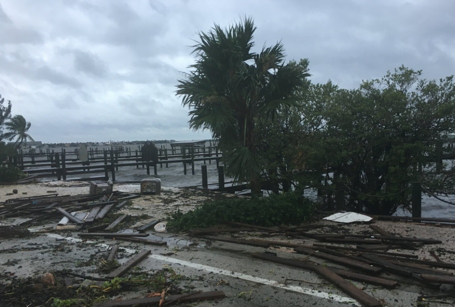
Hurricane Matthew is blasting eastern Florida’s Space Coast, and is set to deliver a punishing combination of storm surge flooding, rainfall flooding, and destructive winds in northeast Florida, Georgia, South Carolina, and southern North Carolina into the weekend. Some areas near the coast in Georgia and South Carolina may see flooding comparable to last October’s event. Wind gusts as high as 107 mph have been clocked at Cape Canaveral, Florida, prompting a rare NWS “extreme wind warning”, as the hurricane’s western outer eyewall scrapes the Space Coast.

Florida Governor Rick Scott just released an update on Hurricane Matthew’s impacts so far. Here are the highlights:
- 600,000 people in the state are without power
- 22,000 people are in shelters
- 145 shelters are open in the state
- All interstates in Florida remain open, without tolls
- Damage assessments are just beginning
- The federal government is providing significant help to the state, including food, water, tarps, generators, search and rescue teams, hazmat assessment teams, cots and blankets.
“We’re only halfway through, we’re going to have more outages,”said Scott. “Power saves lives. We want everybody to get their power back as soon as possible.”

Hurricane Matthew Right Now:
-Category 3 Matthew’s center is hugging Florida’s east coast.
-Wind gusts over 100 mph have already been measured at Cape Canaveral.
-Heavy rainfall and storm surge will combine to trigger major flooding in coastal Georgia and South Carolina.
-The magnitude of the flooding in coastal South Carolina could match last October.
-Matthew will then meander off the Southeast coast well into next week.
To receive similar content, “Like” us on Facebook @ https://www.facebook.com/niagarabuzz.ca